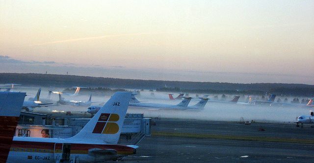
There’s no doubt that landing a giant aircraft in fog is not among a pilot’s favourite things. Fortunately, many airports in the second decade of the 21st century are equipped with advanced instrument landing systems (ILS) sophisticated enough to avoid cancelling operations merely because of foggy conditions.
Pioneered as early as 1929, today’s ILS equipment allows an aircraft crew to perform a runway approach in low-visibility conditions – even in nearly zero-visibility if necessary – by keeping it apprised in real time that the plane is correctly aligned along the runway’s axis and descending at the proper angle to achieve contact with the runway in the correct touchdown zone.

These systems function based on various radio signals emitted by equipment at ground-based installations, as well as corresponding onboard equipment that receives these signals and translates them into relevant information for the pilots.
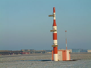
Runway axis alignment data is emitted by radio from an antenna array called a localiser (above), installed beyond the far end of the runway. One of these highly directional signals is slightly oriented to the left, the other to the right; the onboard receiver is capable of detecting the difference between both, and on that basis calculating each aircraft’s position with respect to the runway axis.
 Data regarding aircraft descent along what’s called the glide slope are calculated similarly, but using antennae set up alongside the runway (right). Here again, the onboard instruments can measure the difference in intensity in the signals received and from that calculate whether the aircraft is within the glide path, above it, or below it. The data received from the ILS appears to the pilots on a display which shows them at all times whether they need to adjust their approach in any way; in some models the ILS is even able to transmit landing commands directly to the automatic piloting system.
 It’s also interesting to note that the airport lights we see at night or in low-visibility conditions are not part of the ILS system but rather the ALS (approach lighting system, left), which can complement it, thereby permitting more reduced minimums in the landing operation.
These minimums are what defines the different categories of the ILS, categories I, II, and III. ILS Category I allows landings with a minimum decision height of 61 metres (200 feet) over the level of the runway, and with visibility greater than 800 metres (2,625 feet), or an RVR, the distance at which a pilot can see the runway, the signals which mark its surface, or the lights which mark its axis, from at least 550 metres (1,804 feet). An ILS CAT III B, the most precise of those currently in use, allows landing with no mimum decision height so long as the RVR is not under 75 metres (246 feet); in the United States it’s 50 metres (150 feet).
In addition, apart from whether an airport has an ILS of any type, each aircraft is required to be equipped and its crew trained to use it. For example, in a category III B instrument landing it’s the automatic pilot which takes the aircraft to the point of deceleration down to taxiing speed after landing, so obviously it’s necessary for the plane to have an auto pilot capable of receiving commands from the ILS. It’s also necessary for the plane to possess, for example, an altimetre radar in order to utilise category II and III ILS systems.
The ground portion of the ILS system is able to monitor itself and disconnect automatically if it detects an error – within ten seconds in a CAT I system and in fewer than two seconds in a CAT III.
In practice, air traffic controllers are responsible for guiding an aircraft toward the runway localisers as it approaches the airport, even though multiple planes may be using the ILS simultaneously, indicating the route to follow and enforcing the necessary safety distances between each incoming aircraft (known in navigation terminology as “separation”) which under low-visibility conditions needs to be greater than usual – leading, unfortunately, to delays even at airports with advanced ILS systems.
There is still room for improvement in landing technology, since for example the highly directional nature of the radio signals used by localisers and glide path indicators can be affected by the presence of large nearby structures or even other aircraft on the ground. Thus testing is already underway for systems of the future such as EGNOS (European Geostationary Navigation Overlay Service), which via three satellites and a network of ground-based stations supplements GPS can achieve a precision down to fewer than two metres (6.5 feet) in calculating the location of any vehicle.
A system such as this, moreover, can be utilized at all phases of flight, not just during landing, and will allow separation between aircraft to be safely reduced in all conditions, clear or foggy – thus allowing more efficient use of congested airways and ensuring that passengers get to their destinations on time as much as possible.
And therein lies another blog post…
images | Mikel Vidal, Herr-K, anttilep